Native trails on today's map

Georeferenced historic maps of Native trails, villages and place names, laid over a modern map you can slide between. Start with a state below.

Map of the United States showing which states have historic trail overlays Washington — 2 mapsIdaho — 2 mapsMontana — 2 mapsNorth Dakota — 3 mapsMinnesota — 3 mapsMichigan — 1 mapOhio — 1 mapPennsylvania — 1 mapNew York — 2 mapsVermont — 1 mapNew Hampshire — 1 mapMaine — 1 mapArizona — 2 mapsCalifornia — 2 mapsNew Mexico — 2 mapsTexas — 2 mapsLouisiana — 2 mapsMississippi — 2 mapsAlabama — 2 mapsFlorida — 2 mapsGeorgia — 2 mapsSouth Carolina — 2 mapsNorth Carolina — 2 mapsVirginia — 2 mapsDistrict of Columbia — coming soonMaryland — 1 mapDelaware — 1 mapNew Jersey — 1 mapConnecticut — 1 mapRhode Island — 1 mapMassachusetts — 1 mapOregon — 2 mapsUtah — 2 mapsWyoming — 2 mapsNevada — 2 mapsColorado — 2 mapsSouth Dakota — 3 mapsNebraska — 3 mapsKansas — 2 mapsOklahoma — 2 mapsIowa — 3 mapsMissouri — 2 mapsWisconsin — 2 mapsIllinois — 1 mapKentucky — 2 mapsArkansas — 2 mapsTennessee — 2 mapsWest Virginia — 2 mapsIndiana — 1 map
Dotted lines trace a few of the great routes — the Central Trail, the Warpath, the Natchez Trace. Alaska and Hawaiʻi will be added with their first maps. Request a map for your state.

Maps available now

Preview of Gallatin's tribes of North America, 1836

Gallatin's tribes of North America, 1836

Hon. Albert Gallatin; published by the American Antiquarian Society, Pendleton's Lithography, 1836 · about 100 km accuracy

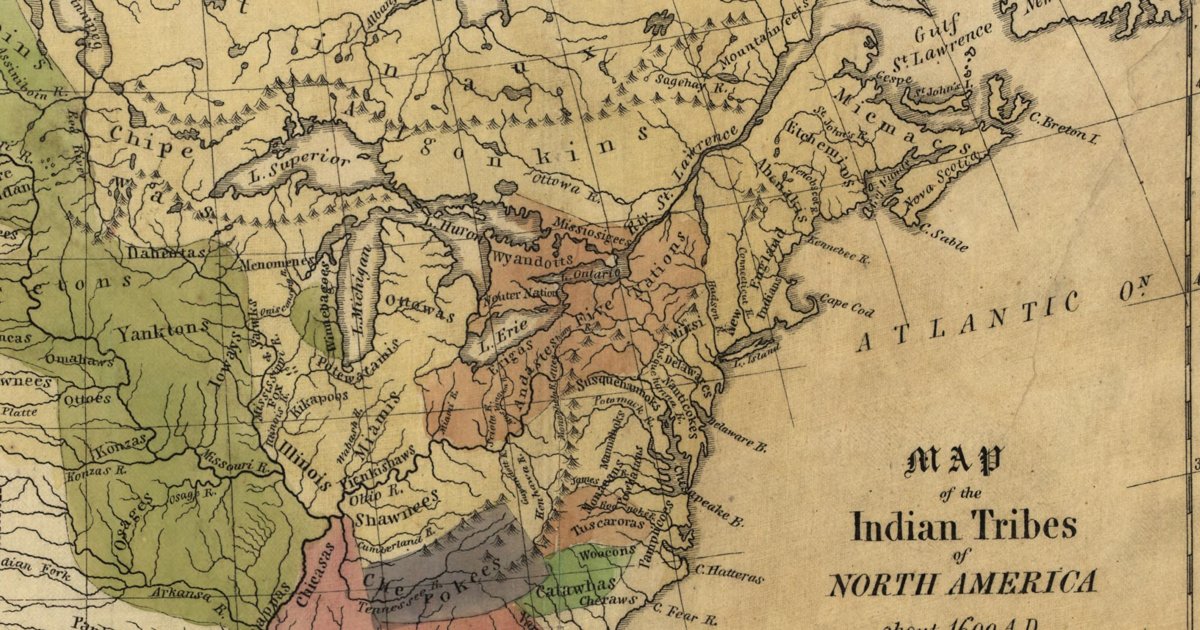
Albert Gallatin's founding map of American ethnology, published by the American Antiquarian Society with his Synopsis of the Indian Tribes: the homelands of the continent's nations tinted by language family — Algonkin-Lenape, Iroquois, Cherokee, Muskogee, Choctaw-Chickasaw, Sioux, Blackfeet, Pawnee, Athapasca, Eskimaux — as of about 1600 along the Atlantic and about 1800 westward. A continental baseline: every state shows its nations here.

Source: Library of Congress, Geography and Map Division · Rights: public domain
Open in the map

Preview of Iroquois trails and villages, 1851

Iroquois trails and villages, 1851

Lewis H. Morgan and Ely S. Parker, 1851 · redrawn 1962 · about 5 km accuracy

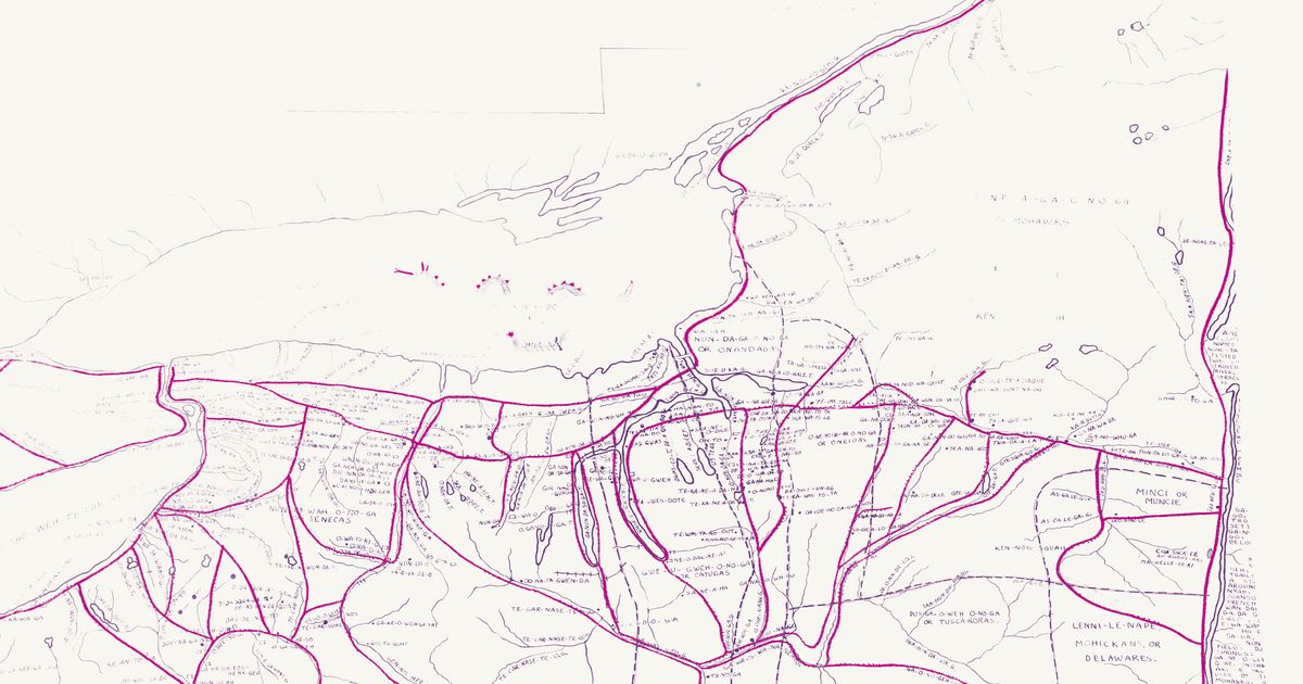
Lewis Henry Morgan and Ely S. Parker's 1851 map of the Haudenosaunee homeland, showing the principal trails, villages, lakes and rivers with their Iroquois names, in Eber L. Russell's 1962 redraw with villages, trails and springs added from fifty years of research. Rubber-sheeted to modern lakes and river junctions.

Source: Norman B. Leventhal Map & Education Center, Boston Public Library · Rights: public domain

Open in the map

Preview of Indian & Oklahoma Territories, 1894

Indian & Oklahoma Territories, 1894

Rand McNally & Co., from General Land Office records, 1894 · about 10 km accuracy

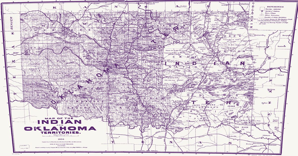
The 1894 Rand McNally map of the Indian and Oklahoma Territories, compiled from the official records of the General Land Office: the Cherokee, Choctaw, Chickasaw, Muscogee (Creek), Seminole and Osage Nations with their districts and capitals, the agencies and military reservations of the western tribes, treaty citations, trails, wagon roads and mail routes on the eve of allotment.

Source: Library of Congress, Geography and Map Division · Rights: public domain
Open in the map

Preview of Southeastern trail system, 1928

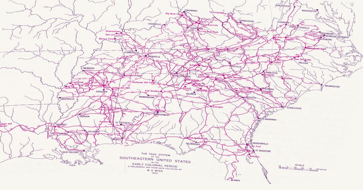
Southeastern trail system, 1928

William Edward Myer, 1928 · about 10 km accuracy

William E. Myer's preliminary map of the trail network of the colonial-era Southeast, compiled for the Bureau of American Ethnology from early maps, land records and field work: over 125 numbered trails, historic towns and sites from the Ohio River to the Gulf and from the Mississippi to the Atlantic. Georeferenced to thirty modern city locations.

Source: 42nd Annual Report of the Bureau of American Ethnology (Smithsonian Institution, GPO); scan via Yale Beinecke Library / Wikimedia Commons · Rights: public domain

Open in the map

Preview of Nicollet's Upper Mississippi, 1843

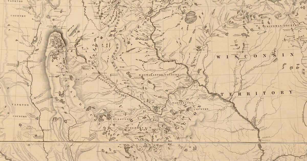
Nicollet's Upper Mississippi, 1843

J. N. Nicollet, assisted by J. C. Frémont; U.S. War Department, Bureau of the Corps of Topographical Engineers, 1843 · about 25 km accuracy

Joseph Nicollet and John C. Frémont's War Department map of the upper Mississippi country — the most accurate map of its era, made with Dakota and Ojibwe guides. It names each nation's country — Mdewakanton, Wahpekute, Sisseton, Yankton, Yanktonai, Teton, Ojibwe, Ho-Chunk, Sac and Fox, Omaha, Otoe, Ioway, Ponca, Pawnee — with villages and hundreds of Dakota and Ojibwe place names: Mini Wakan, Kichi Gummi, Minsi Sagaigoning.

Source: Library of Congress, Geography and Map Division · Rights: public domain
Open in the map

Preview of Warren's map of the West, 1857

Warren's map of the West, 1857

Lieut. G. K. Warren, Topographical Engineers, U.S. War Department, 1857 · about 50 km accuracy

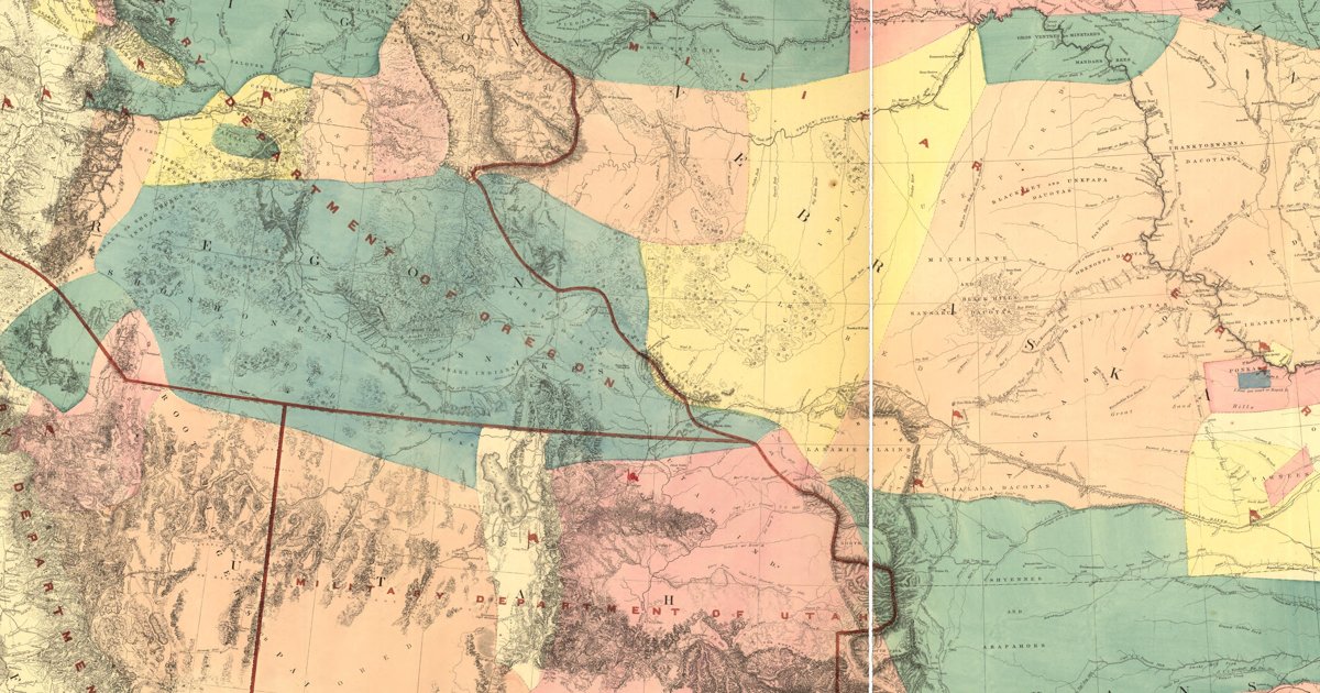
Lieutenant G. K. Warren's master map of the West, compiled in the Office of Pacific Railroad Surveys from every reliable exploration to date: the named country of each nation — Dacotas, Sheyennes, Comanches, Shoshonees, Utahs, Navajoes, Apaches, Blackfeet, Crows, Nez Perces, Pawnees and many more — with villages, forts, and the explorers' and emigrant routes that followed Native trails.

Source: Library of Congress, Geography and Map Division · Rights: public domain
Open in the map

How it works

  1. A historic map is scanned by an archive and its rights checked.
  2. We read dozens of control points from lakes, rivers and towns and warp the sheet onto real coordinates (method).
  3. The trails and lettering become a transparent layer you can fade over today's roads, compare side by side, or search by historic name.

States